
What is Meaning of GPS ( Global Positioning system ) :-

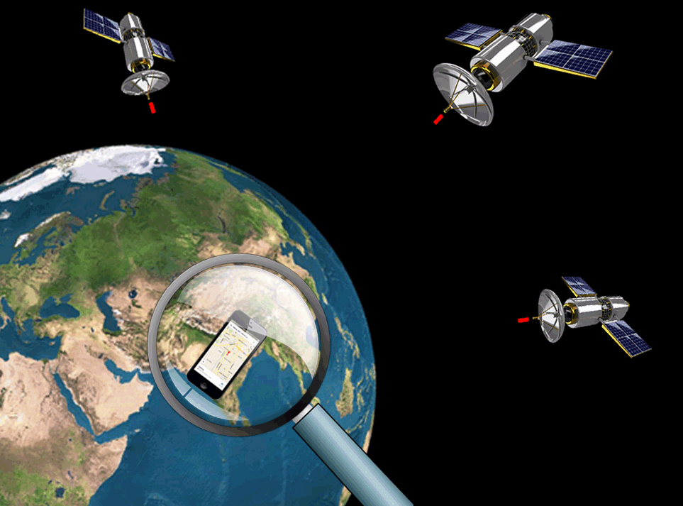
GPS is a network consisting of 30 satellites revolving around the earth at an altitude of 20,000 km and it completes two full orbits every day. It works in all the weather conditions unless and until if there is no obstacle in the transmission of the signals from the satellite to the receiver. Obstacles are said to be the mountains and the buildings which weaken the signal strength coming from the GPS satellites. GPS will not require the user to transmit the data. It works independently with the help of the internet. Once it receives the signal, it will automatically identify the time and location where the person is exactly located. The GPS is very useful for the military, civil and commercial sectors around the world.
History of GPS ( Global Positioning system ) :-

GPS is originated in United States of America for their military purposes. The U.S. Department of Defense developed the GPS system with comprising of 24 satellites. Gradually the importance of the GPS is known to everyone and all the countries started to have GPS system. The system is designed in such a way that it should provide global coverage. The accuracy of it will be from 500 m to 30 cm. First launch was done on 1948 by US and it was successful.
Global positioning system is also known as NAVSTAR. It is nothing but a cluster of satellites provide GPS services. GPS was originally invented by U.S. Department of defence with satellite based three dimensional positioning system, which operates for 24*7 and provides worldwide coverage. Initially it was designed with only four satellites testing the accuracy in providing the information regarding the location and measured the time for the signal to travel from the satellite to the receiver.
The United States government created this system and makes it accessible to all the users who has a GPS receiver. GPS is also used in defense. Originally the U.S. government planned to have GPS in defense with 24 satellites.
Related :-
Warehouse and Warehousing Storage
Types of Warehouse
Warehouse Management WMS Services
Heavy Duty Trucks and Crane Rental Services
GPS ( Global Positioning system ) satellites:-

Global positioning system is made up of 24 satellites. Without satellites there will be no concept called GPS. Satellites will be revolving around the earth continuously. They will receive signals from the space and transmit the acquired signals to the GPS receivers. Then the receivers will be able to use these signals to provide three-dimensional location .i.e. latitude, longitude, and altitude information and also the current time.
According to the recent update, 73 GPS navigation satellites have been launched on December 2018. Navigation satellites will make use of artificial satellite for providing geo-spatial positioning. It will be really helpful in providing the exact location with high accuracy.
Working of the GPS ( Global Positioning system ) satellites:-
There will be six orbits available in the space around the earth. So, these 24 GPS satellites are uniformly distributed in the six orbits such that there will be four satellites per orbit. Satellites will not directly transmit the signals to the receiver. Ground stations will be present in between the satellite and the receiver. The accuracy of the GPS satellite system depends on the ground station. If the ground station is not constantly updated then there will be changes in the accuracy of the GPS satellite system. The life time of the satellites will be 10 years after that their signals will be useless and weaker.
GPS ( Global Positioning system ) definition:-

GPS which stands for Global Positioning System, is a network consisting of 24 satellites revolving around the earth in 6 orbits where all the satellites are evenly distributed in all the six orbits. These satellites will be helpful in acquiring the signals from the space and provide accurate results regarding the position. Satellites revolves around the world at an altitude of 20,000km and it completes two full orbits every day.
It works in all the weather conditions unless and until if there is no obstacle in the transmission of the signals from the satellite to the receiver. Obstacles are said to be the mountains and the buildings which weaken the signal strength coming from the GPS satellites. GPS will not require the user to transmit the data. It works independently with the help of the internet. Once it receives the signal, it will automatically identify the time and location where the person is exactly located. The GPS is very useful for the military, civil and commercial sectors around the world.
GPS is also a radio navigation system that allows the persons travelling in the airplane, sea to determine the exact location. Not only the location but also we can identify the speed and time. It operates in all the weather conditions.
How GPS ( Global Positioning system ) works (Latitude-Longitude):-

I have mentioned below the working of GPS along latitude and longitude position.GPS usually works by a method called TRIANGULATION (Latitude, Longitude and altitude). Global positioning system will provide the information regarding the location and the time if it receive the message from any of the four satellites or at least three satellites from the total 24 satellites.
In order to triangulate, GPS receiver will measure the distance between itself and each satellite because it calculates how long it takes for the satellite’s message to arrive. The calculated time should be very accurate. Along with time calculation, the distance of the satellite from the space should also be known. By calculating the time and the distance, we can say how far the satellite is located from the ground.
By accurately measuring the time and the distance from at least any of the three/ four satellites we can triangulate and find our position anywhere on the earth. Triangulation is the main idea behind GPS.
GPS ( Global Positioning system ) receiver:-

GPS receiver is nothing but it receives signals from the satellites revolving around the earth and provides information about the location and the current time. The accuracy of the GPS receiver is based on the signals it receives from the number of satellites. If it receives signals from more satellites then the accuracy will also be high. GPS receiver will calculate the latitude, longitude and the altitude position by measuring the speed of light, delays in the signal coming from the satellites.
In order to triangulate, GPS receiver will measure the distance between itself and each satellite because it calculates how long it takes for the satellite’s message to arrive. The calculated time should be very accurate. Along with time calculation, the distance of the satellite from the space should also be known. By calculating the time and the distance, we can say how far the satellite is located from the ground. By accurately measuring the time and the distance from at least any of the three/ four satellites we can triangulate and find our position anywhere on the earth. Triangulation is the main idea behind GPS.
GPS receiver will measure the distance between itself and each satellite because it calculates how long it takes for the satellite’s message to arrive. The calculated time should be very accurate. Along with time calculation, the distance of the satellite from the space should also be known. By calculating the time and the distance, we can say how far the satellite is located from the ground.
GPS receiver will not directly receive signals from the space. Ground stations will be present in between the satellite and the receiver. If the ground station is not constantly updated then there will be changes in the accuracy of the GPS satellite system.
Uses of GPS ( Global Positioning system ) :-

GPS is used in all the private and government sectors. I have listed few uses for the better understanding.
- If we are going to an unknown location we need not worry if we forget the location. GPS will help us in identifying the location and also show us the map where we want to exactly go. If we want to enjoy this app then we should have a mobile phone with GPS.
- Help farmers to harvest their field. GPS also allows more application related to the farming and it will help the farmers providing the ideas on how to work even during in the poor weather conditions.
- Military applications With the help of GPS, the emergency crews in the military will try to locate the people who are really in need of assistance.
- Routing the airplanes with the help of the signals provided by the GPS.
- Tourist people can make use of the GPS in identifying the unknown location or even forest map is shown in GPS.
- Used almost in all the industry sectors
- Police department GPS is useful in identifying the criminal’s location.
- Control over our assets With the help of GPS we can track the location of the asset and control them.
- GPS can be used in Mobile phones. It uses radio waves to transmit the signals between the satellite and the receiver. We can track the location and the time using the mobile phones. Nowadays people prefer to buy smartphones which has GPS access.
- We can also track someone without knowing by them. This would be very helpful if we want to personally track some one’s location.
GPS ( Global Positioning system ) system success in India:-

GPS made a very huge impact in our society. People changed the way they live by looking into the advancement in our technology. Government is still working on our safety and introducing more apps and making changes in the technology. This made us to change our life style and having our environment safe. More and more advancement in the technology making us learn more and having our place easier to live without any fear about the criminals.
GPS works without an internet connection whereas the google map requires an internet connection. If you download the map then it can be used without an internet connection. Modern smartphone has a GPS chip in it. We can determine the location offline by downloading the google map. By considering the enormous uses of the GPS, India planned to have the GPS on its own. There had been talks going on in the parliament regarding the satellite. Dream comes true on 2013.
India launched IRNSS-1A, on 1st July 2013 and IRNSS-1B was launched on 4th April 2014. Since last year 2018 we have a GPS for our public use. It consists of seven satellites and the purpose of that GPS is, if we lose our way in any part of the country or in the sea NavIC will come to save us.
Related :-
Trucks Truckers and Trucking
Goods Transportation Problems
Logistics Overview
Factories Survey
NavIC has come from the name of the Indian Regional Navigation Satellite System (IRNSS). It had been tested for the accuracy and have come for the public use since 2018. We have been dependent on GPS with US for so many years. Now, India has a GPS on its own. This NavIC will cover only India and the surroundings. When compared to the GPS owned by U.S. NavIC has more accuracy than any of the Global positioning system.
GPS ( Global Positioning system ) has provided the safer environment. Let us enjoy the GPS technology and change our life style.
Please click & See Our Endless Journey – Please Click
Indian Regional Navigation Satellite System ISRO :- www.isro.gov.in
National Center of Geo-Informatics (NCoG) :- www.ncog.gov.in
GPS Global Positioning System Public FAQ :-
